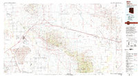
1994 Map of Willcox
USGS Topo · Published 1994About this map
Sulphur Springs Valley and the San Simon Valley dominate this High Desert landscape, framed by the dramatic elevations of the Dos Cabezas Mountains and the northern reaches of the Chiricahua Mountains. At the heart of the basin lies the Willcox Playa, containing the Willcox Dry Lake and its associated Willcox Bombing Range. This area reflects a complex layering of land use, from the agricultural pockets of the Kansas Settlement to the protected wilderness of Chiricahua National Monument.
Find a feature on this map
51 named features on this map. Tap any name to fly to it.
Don’t see what you’re looking for? This feature index may not catch every label — zoom into the map to look around manually.
Map Details
Editions of this 1994 Willcox Map
2 editions found
Other maps of this area

1915 · Benson
USGS Topo · 1:125,000

1916 · Pearce
USGS Topo · 1:125,000

1917 · San Simon
USGS Topo · 1:125,000

1917 · Chiricahua
USGS Topo · 1:125,000

1918 · Pratt
USGS Topo · 1:62,500

1919 · Pratt
USGS Topo · 1:62,500

1919 · Chiricahua
USGS Topo · 1:125,000

1922 · Willcox
USGS Topo · 1:125,000

1922 · St. David
USGS Topo · 1:62,500

1926 · Light
USGS Topo · 1:62,500