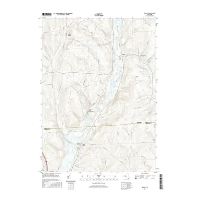
2016 Map of Willet
USGS Topo · Published 2016About this map
The Otselic River carves a deep valley through this region of the Southern Tier, serving as the central geographic feature for the small settlements of Willet and Georgetown. The landscape is defined by its numerous watercourses and family-named landmarks, including Ticknor Brook, Miller Brook, and Landers Cr. Local history is preserved in a network of rural burying grounds such as Willet Village Cem and Beardsley Cem.
Find a feature on this map
86 named features on this map. Tap any name to fly to it.
Don’t see what you’re looking for? This feature index may not catch every label — zoom into the map to look around manually.
Map Details
Editions of this 2016 Willet Map
This is the sole edition of this map. No revisions or reprints were ever made.
Other maps of this area

1903 · Cortland
USGS Topo · 1:62,500

1903 · Harford
USGS Topo · 1:62,500

1904 · Greene
USGS Topo · 1:62,500

1904 · Pitcher
USGS Topo · 1:62,500

1906 · Catatonk
USGS Topo · 1:125,000

1943 · Cincinnatus
USGS Topo · 1:24,000

1943 · Pitcher
USGS Topo · 1:24,000
1944 · Pitcher
USGS Topo · 1:31,680
1944 · Mc Graw
USGS Topo · 1:31,680
1944 · Cincinnatus
USGS Topo · 1:31,680