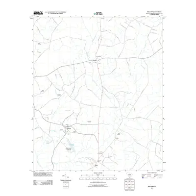
2011 Map of Williams
USGS Topo · Published 2011About this map
Smoaks and Williams anchor this rural Colleton County landscape, where small crossroads communities are defined by their post offices and numerous family burial grounds. The territory is a network of slow-moving water, with Buckhead Creek winding south toward its confluence near the Little Salkehatchie River. Genealogy researchers will find significant value in the documentation of several family and community landmarks, such as the Colonel Joseph Risher Cemetery and the Warren-Key Cemetery. This 2011 survey captures the area's agricultural character, dominated by named farms and quiet settlements like Smyly and Ruffin. Infrastructure like the South Carolina Noname-15028 D-2383 Dam at J J Padgett Pond illustrates the local management of the Lowcountry's wetlands and waterways.
Find a feature on this map
77 named features on this map. Tap any name to fly to it.
Don’t see what you’re looking for? This feature index may not catch every label — zoom into the map to look around manually.
Map Details
Editions of this 2011 Williams Map
This is the sole edition of this map. No revisions or reprints were ever made.
Other maps of this area

1918 · Walterboro
USGS Topo · 1:62,500

1919 · Cummings
USGS Topo · 1:62,500

1919 · Lodge
USGS Topo · 1:62,500

1920 · Lodge
USGS Topo · 1:48,000

1920 · St. George
USGS Topo · 1:48,000

1921 · Lodge
USGS Topo · 1:62,500

1921 · St. George
USGS Topo · 1:62,500

1943 · Lodge
USGS Topo · 1:62,500

1943 · Orangeburg
USGS Topo · 1:125,000

1943 · Cummings
USGS Topo · 1:62,500