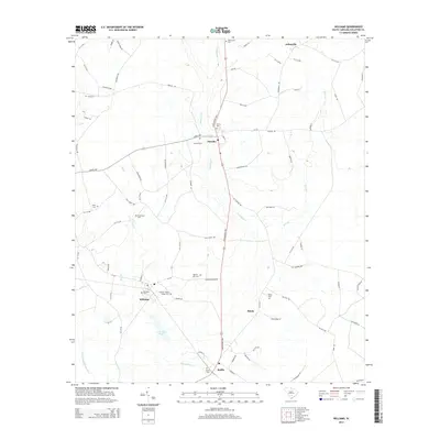
2014 Map of Williams
USGS Topo · Published 2014About this map
Smoaks and Williams anchor this region of Colleton County, where the Lowcountry landscape is defined by the winding course of Buckhead Cr and the Little Salkehatchie River. The settlement pattern is deeply rooted in local lineage, evidenced by a high density of family and community burial grounds such as the Colonel Joseph Risher Cem, Warren - Key Cem, and Strickland Cem. These sites, alongside landmarks like J J Padgett Pond, provide a detailed view of the rural geography of the South Carolina coastal plain. Further south, the map details the community of Ruffin and the Smyly area, connected by a network of secondary roads and state highways like the Lowcountry Hwy. The presence of numerous small tributaries such as Hog Br, Bear Br, and Steedley Br reflects the intricate drainage system typical of the Salkehatchie basin.
Find a feature on this map
84 named features on this map. Tap any name to fly to it.
Don’t see what you’re looking for? This feature index may not catch every label — zoom into the map to look around manually.
Map Details
Editions of this 2014 Williams Map
This is the sole edition of this map. No revisions or reprints were ever made.
Other maps of this area

1918 · Walterboro
USGS Topo · 1:62,500

1919 · Cummings
USGS Topo · 1:62,500

1919 · Lodge
USGS Topo · 1:62,500

1920 · Lodge
USGS Topo · 1:48,000

1920 · St. George
USGS Topo · 1:48,000

1921 · Lodge
USGS Topo · 1:62,500

1921 · St. George
USGS Topo · 1:62,500

1943 · Lodge
USGS Topo · 1:62,500

1943 · Orangeburg
USGS Topo · 1:125,000

1943 · Cummings
USGS Topo · 1:62,500