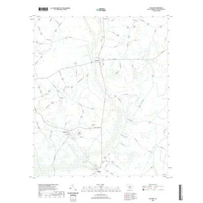
2020 Map of Williams
USGS Topo · Published 2020About this map
Smoaks, Williams, and Ruffin anchor this low-lying stretch of Colleton County, where the Little Salkehatchie River and several of its tributaries, including Buckhead Cr and Deep Bottom Cr, shape the agricultural landscape. The area is notable for its high density of family and community burial grounds, such as the Colonel Joseph Risher Cem, Warren Key Cem, and Strickland Cem, which provide significant points of interest for genealogists and local historians. The CSX Transportation line cuts through the southwestern corner, connecting these rural outposts. The terrain is marked by distinctive features like Horse Bay and Adobe Flats, illustrating the unique hydrology of the South Carolina Coastal Plain where wetlands and stream beds often define property and municipal boundaries.
Find a feature on this map
79 named features on this map. Tap any name to fly to it.
Don’t see what you’re looking for? This feature index may not catch every label — zoom into the map to look around manually.
Map Details
Editions of this 2020 Williams Map
This is the sole edition of this map. No revisions or reprints were ever made.
Other maps of this area

1918 · Walterboro
USGS Topo · 1:62,500

1919 · Cummings
USGS Topo · 1:62,500

1919 · Lodge
USGS Topo · 1:62,500

1920 · Lodge
USGS Topo · 1:48,000

1920 · St. George
USGS Topo · 1:48,000

1921 · Lodge
USGS Topo · 1:62,500

1921 · St. George
USGS Topo · 1:62,500

1943 · Lodge
USGS Topo · 1:62,500

1943 · Orangeburg
USGS Topo · 1:125,000

1943 · Cummings
USGS Topo · 1:62,500