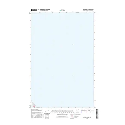
2016 Map of Williams NW OE E
USGS Topo · Published 2016About this map
Lake of the Woods County is the primary focus of this modern geographic survey, which covers a remote section of Northern Minnesota during the mid-2010s. The landscape is defined by the Public Land Survey System coordinates T162n R33w, reflecting the foundational legal grid used to organize the territory. This particular map is uniquely sparse, focusing on a vast expanse of wetland or water without the presence of named settlements, roads, or man-made landmarks. It represents a specific type of environmental data collection where hydrography and wetland inventory dominate the record, documenting the pristine state of the northern borderlands as they were monitored by federal agencies like the U.S. Geological Survey.
Find a feature on this map
1 named feature on this map. Tap any name to fly to it.
Don’t see what you’re looking for? This feature index may not catch every label — zoom into the map to look around manually.
Map Details
Editions of this 2016 Williams NW OE E Map
This is the sole edition of this map. No revisions or reprints were ever made.
Other maps of this area

1918 · Williams
USGS Topo · 1:62,500

1919 · Canada
USGS Topo · 1:62,500

1954 · Roseau
USGS Topo · 1:250,000

1957 · Roseau
USGS Topo · 1:250,000

1958 · Roseau
USGS Topo · 1:250,000

1963 · Kenora
USGS Topo · 1:250,000

1967 · Williams
USGS Topo · 1:24,000
1967 · Williams NW
USGS Topo · 1:24,000
1967 · Williams SE
USGS Topo · 1:24,000
1967 · Wheelers Point
USGS Topo · 1:24,000