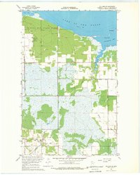
1967 Map of Williams SE
USGS Topo · Published 1969About this map
Zippel Bay State Park anchors the shoreline along the southern reaches of Lake of the Woods in this late-1960s survey. The landscape is defined by the transition from open water and sandy points like Morris Point to the extensive lowlands and wetlands further south. Human modification of the terrain is evident in the straight lines of Judicial Ditch No 28, part of a drainage system designed to manage the saturation of these northern woods. The map also shows a portion of the Red Lake Indian Reservation in the northwestern corner, while several Gravel Pits indicate local resource extraction near the bay. Waterways such as Bostick Creek, Wabanica Creek, and Canfield Creek meander through the timbered sections, illustrating the complex hydrography of the region before further modern development.
Find a feature on this map
14 named features on this map. Tap any name to fly to it.
Don’t see what you’re looking for? This feature index may not catch every label — zoom into the map to look around manually.
Map Details
Editions of this 1967 Williams SE Map
This is the sole edition of this map. No revisions or reprints were ever made.
Other maps of this area

1918 · Williams
USGS Topo · 1:62,500

1919 · Peppermint Creek
USGS Topo · 1:62,500

1919 · Canada
USGS Topo · 1:62,500

1921 · Baudette
USGS Topo · 1:62,500

1943 · Peppermint Creek
USGS Topo · 1:62,500

1954 · Roseau
USGS Topo · 1:250,000

1957 · Roseau
USGS Topo · 1:250,000

1958 · Roseau
USGS Topo · 1:250,000

1967 · Williams
USGS Topo · 1:24,000
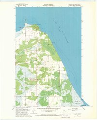
1967 · Williams NW
USGS Topo · 1:24,000