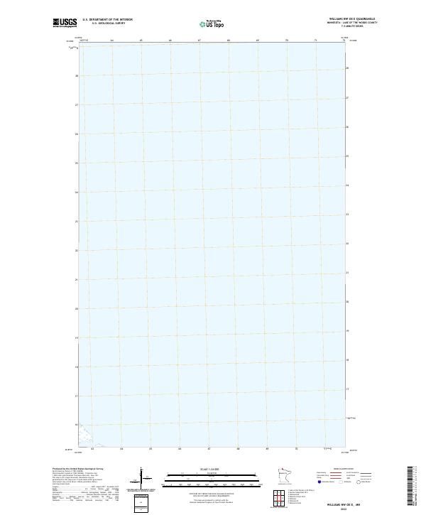
2022 Map of Williams NW OE E
USGS Topo · Published 2022About this map
Lake of the Woods County is presented in this 2022 survey as a nearly pure aquatic expanse, capturing a remote northern Minnesota landscape defined by the water of the lake itself. The sheet is primarily comprised of open water, with only a small fragment of land appearing in the extreme southwest corner near the township boundary of T162n R33w. This map serves as a modern cartographic record of the international border region, showing the lack of terrestrial development or infrastructure in this specific quadrant of the Lake of the Woods basin.
Find a feature on this map
1 named feature on this map. Tap any name to fly to it.
Don’t see what you’re looking for? This feature index may not catch every label — zoom into the map to look around manually.
Map Details
Editions of this 2022 Williams NW OE E Map
This is the sole edition of this map. No revisions or reprints were ever made.
Other maps of this area

1918 · Williams
USGS Topo · 1:62,500

1919 · Canada
USGS Topo · 1:62,500

1954 · Roseau
USGS Topo · 1:250,000

1957 · Roseau
USGS Topo · 1:250,000

1958 · Roseau
USGS Topo · 1:250,000

1963 · Kenora
USGS Topo · 1:250,000

1967 · Williams
USGS Topo · 1:24,000
1967 · Williams NW
USGS Topo · 1:24,000
1967 · Williams SE
USGS Topo · 1:24,000
1967 · Wheelers Point
USGS Topo · 1:24,000