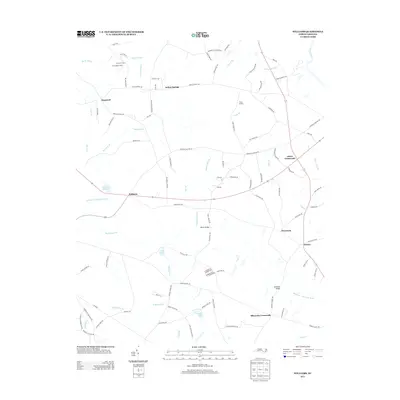
2013 Map of Williams
USGS Topo · Published 2013About this map
The Northeast Cape Fear River snakes through this rural corner of Wayne County, defining a landscape of agriculture and scattered crossroads. Settlement patterns are rooted in historic intersections and water features, from Williams Millpond near the center to the namesake community of Williams. The area is characterized by several distinct crossroads such as Hines Crossroads, Pricetown, and Blizzards Crossroads, which historically served as local hubs for the surrounding farmsteads.
Find a feature on this map
103 named features on this map. Tap any name to fly to it.
Don’t see what you’re looking for? This feature index may not catch every label — zoom into the map to look around manually.
Map Details
Editions of this 2013 Williams Map
This is the sole edition of this map. No revisions or reprints were ever made.
Other maps of this area

1953 · Rocky Mount
USGS Topo · 1:250,000

1953 · Raleigh
USGS Topo · 1:250,000

1954 · Rocky Mount
USGS Topo · 1:250,000

1954 · Raleigh
USGS Topo · 1:250,000

1957 · Goldsboro
USGS Topo · 1:62,500

1957 · Seven Springs
USGS Topo · 1:62,500

1974 · Southwest Goldsboro
USGS Topo · 1:24,000
1977 · Warsaw North
USGS Topo · 1:24,000
1977 · Mount Olive
USGS Topo · 1:24,000

1980 · Seven Springs
USGS Topo · 1:24,000