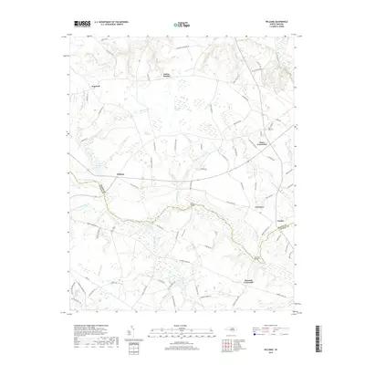
2019 Map of Williams
USGS Topo · Published 2019About this map
The Northeast Cape Fear River carves a winding path through this corner of eastern North Carolina, marking the jurisdictional line between Wayne Co and Duplin Co. The landscape is a mosaic of agriculture and dense wetlands, characterized by distinct ecological features such as the Horsepen Pocosin and the curious Devils Woodyard. Small rural settlements like Hopewell, Indian Springs, and Williams serve as the primary hubs, connected by a network of roads that lead to family-named landmarks and historical crossings.
Find a feature on this map
91 named features on this map. Tap any name to fly to it.
Don’t see what you’re looking for? This feature index may not catch every label — zoom into the map to look around manually.
Map Details
Editions of this 2019 Williams Map
This is the sole edition of this map. No revisions or reprints were ever made.
Other maps of this area

1953 · Rocky Mount
USGS Topo · 1:250,000

1953 · Raleigh
USGS Topo · 1:250,000

1954 · Rocky Mount
USGS Topo · 1:250,000

1954 · Raleigh
USGS Topo · 1:250,000

1957 · Goldsboro
USGS Topo · 1:62,500

1957 · Seven Springs
USGS Topo · 1:62,500

1974 · Southwest Goldsboro
USGS Topo · 1:24,000
1977 · Warsaw North
USGS Topo · 1:24,000
1977 · Mount Olive
USGS Topo · 1:24,000

1980 · Seven Springs
USGS Topo · 1:24,000