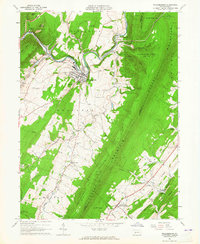
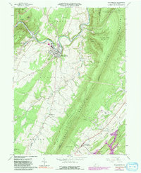
1963 Map of Williamsburg
USGS Topo · Published 1965About this map
Williamsburg and the surrounding Ridge-and-Valley province appear in high detail during the early 1960s, a period when the Pennsylvania railroad still shaped the local industrial landscape. The Frankstown Branch Juniata River carves a path between Canoe Mtn and Lock Mtn, while the towering presence of Tussey Mountain dominates the eastern half of the sheet. The map reveals a dense network of family-named cemeteries and rural churches, including Snively Cem, David Beck Cem, and St Johns Ch, which serve as vital markers for genealogical research.
Find a feature on this map
68 named features on this map. Tap any name to fly to it.
Don’t see what you’re looking for? This feature index may not catch every label — zoom into the map to look around manually.
Map Details
Editions of this 1963 Williamsburg Map
5 editions found
Other maps of this area

1901 · Huntingdon
USGS Topo · 1:62,500

1902 · Hollidaysburg
USGS Topo · 1:62,500

1903 · Hollidaysburg
USGS Topo · 1:62,500

1904 · Huntingdon
USGS Topo · 1:62,500

1920 · Altoona
USGS Topo · 1:62,500

1922 · Altoona
USGS Topo · 1:62,500

1923 · Tyrone
USGS Topo · 1:62,500

1929 · Tyrone
USGS Topo · 1:48,000

1933 · Tyrone
USGS Topo · 1:62,500

1946 · Tyrone
USGS Topo · 1:62,500
Featured Places
- Frankstown Township, PA
- Williamsburg, PA
- Marklesburg, PA
- Larke, Woodbury Township
- Franklin Forge, Woodbury Township