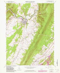
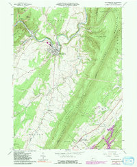
1963 Map of Williamsburg
USGS Topo · Published 1982About this map
Williamsburg serves as the central hub of this Blair County landscape, where the Frankstown Branch Juniata River carves through the Appalachian ridges. The map documents a period of industrial and infrastructure transition, showing the Conrail line alongside the town's powerplant and substation. To the south, the expansion of Raystown Lake begins to dominate the corner of the sheet, contrasting with the long-established agricultural valley along Clover Creek.
Find a feature on this map
65 named features on this map. Tap any name to fly to it.
Don’t see what you’re looking for? This feature index may not catch every label — zoom into the map to look around manually.
Map Details
Editions of this 1963 Williamsburg Map
5 editions found
Other maps of this area

1901 · Huntingdon
USGS Topo · 1:62,500

1902 · Hollidaysburg
USGS Topo · 1:62,500

1903 · Hollidaysburg
USGS Topo · 1:62,500

1904 · Huntingdon
USGS Topo · 1:62,500

1920 · Altoona
USGS Topo · 1:62,500

1922 · Altoona
USGS Topo · 1:62,500

1923 · Tyrone
USGS Topo · 1:62,500

1929 · Tyrone
USGS Topo · 1:48,000

1933 · Tyrone
USGS Topo · 1:62,500

1946 · Tyrone
USGS Topo · 1:62,500
Featured Places
- Frankstown Township, PA
- Williamsburg, PA
- Marklesburg, PA
- Larke, Woodbury Township
- Franklin Forge, Woodbury Township