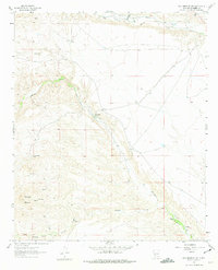
1961 Map of Williamsburg NW
USGS Topo · Published 1975About this map
San Miguel sits at the heart of this Sierra County landscape, where the management of water is paramount to the local settlement pattern. The 1961 field check documents a network of irrigation and transport, including the Palomas Community Ditch, a smaller Community Ditch, and even an Aqueduct near the southern boundary. These features, along with the unnamed church at San Miguel, suggest a small but organized agricultural community reliant on the flows of Palomas Creek and Salado Creek.
Find a feature on this map
17 named features on this map. Tap any name to fly to it.
Don’t see what you’re looking for? This feature index may not catch every label — zoom into the map to look around manually.
Map Details
Editions of this 1961 Williamsburg NW Map
2 editions found
Other maps of this area

1954 · Tularosa
USGS Topo · 1:250,000

1958 · Tularosa
USGS Topo · 1:250,000

1961 · Priest Tank
USGS Topo · 1:24,000

1961 · Huerfano Hill
USGS Topo · 1:24,000

1961 · Saladone Tank
USGS Topo · 1:24,000

1961 · Williamsburg NW
USGS Topo · 1:24,000

1961 · Williamsburg
USGS Topo · 1:24,000

1961 · Cuchillo
USGS Topo · 1:24,000

1963 · Bell Mountain
USGS Topo · 1:24,000

1963 · Thumb Tank Peak
USGS Topo · 1:24,000