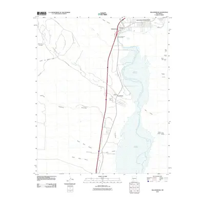
2010 Map of Williamsburg
USGS Topo · Published 2010About this map
Williamsburg and the southern reaches of Truth or Consequences occupy the northern edge of this landscape, where the Rio Grande flows into the expansive Caballo Reservoir. The transition from urban centers to the recreation areas of Caballo Lake State Park is defined by a network of arroyos and canyons, including the significant Palomas Creek drainage. Mining claims and historical workings are scattered across the eastern and western uplands, including the Dakota Group Mine and the Franklin Number One Mine. This era shows the developed corridor along the Truth or Consequences South Interchange, while the presence of the Williamsburg Post Office and Palomas Cemetery near the settlement of Las Palomas provides essential landmarks for those tracing the community's local history and development in the early 21st century.
Find a feature on this map
41 named features on this map. Tap any name to fly to it.
Don’t see what you’re looking for? This feature index may not catch every label — zoom into the map to look around manually.
Map Details
Editions of this 2010 Williamsburg Map
This is the sole edition of this map. No revisions or reprints were ever made.
Other maps of this area

1954 · Tularosa
USGS Topo · 1:250,000

1955 · Las Cruces
USGS Topo · 1:250,000

1958 · Las Cruces
USGS Topo · 1:250,000

1958 · Tularosa
USGS Topo · 1:250,000

1958 · Elephant Butte
USGS Topo · 1:24,000

1959 · Engle
USGS Topo · 1:62,500

1959 · Upham
USGS Topo · 1:62,500

1961 · Skute Stone Arroyo
USGS Topo · 1:24,000

1961 · Saladone Tank
USGS Topo · 1:24,000

1961 · Caballo
USGS Topo · 1:24,000