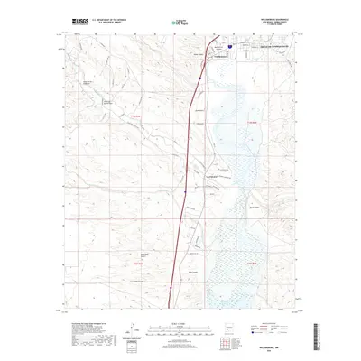
2020 Map of Williamsburg
USGS Topo · Published 2020About this map
Truth Or Consequences and Williamsburg occupy the northern reaches of this Sierra County landscape, situated where the Rio Grande flows southward. The terrain transitions from the high, dissected plateaus of the west, marked by deep drainages like Canon de Molino Viejo and North Kelly Canyon, toward the fertile Rincon Valley and the northern extent of the Caballo Reservoir. The settlement at Las Palomas sits near the confluence of Palomas Creek and the reservoir, maintaining its historic identity with the Las Palomas Cem on the outskirts. The map illustrates a modern infrastructure of roads like Alta Vista Rd and King Canyon Rd superimposed over traditional land divisions. This area remains a critical water management zone, where ephemeral washes such as King Arroyo and Palomas Creek feed into the primary river corridor, shaping the local agriculture and topography.
Find a feature on this map
67 named features on this map. Tap any name to fly to it.
Don’t see what you’re looking for? This feature index may not catch every label — zoom into the map to look around manually.
Map Details
Editions of this 2020 Williamsburg Map
This is the sole edition of this map. No revisions or reprints were ever made.
Other maps of this area

1954 · Tularosa
USGS Topo · 1:250,000

1955 · Las Cruces
USGS Topo · 1:250,000

1958 · Las Cruces
USGS Topo · 1:250,000

1958 · Tularosa
USGS Topo · 1:250,000

1958 · Elephant Butte
USGS Topo · 1:24,000

1959 · Engle
USGS Topo · 1:62,500

1959 · Upham
USGS Topo · 1:62,500

1961 · Skute Stone Arroyo
USGS Topo · 1:24,000

1961 · Saladone Tank
USGS Topo · 1:24,000

1961 · Caballo
USGS Topo · 1:24,000