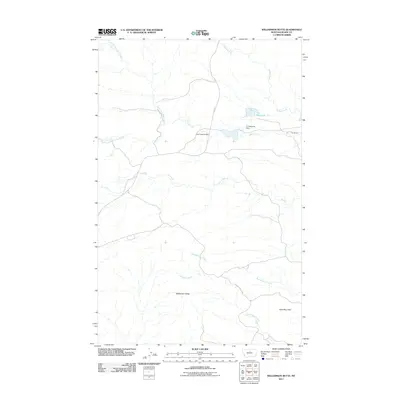
2011 Map of Williamson Butte
USGS Topo · Published 2011About this map
Williamson Butte and Goat Mountain anchor the high ground in this arid reach of Blaine County, where the landscape is defined by the complex drainage of the Cow Creek system. Ranching infrastructure remains the primary human footprint, centered on the T U Ranch and the associated T U Reservoir, which is secured by the T U Reservoir Dam. The network of seasonal watercourses like Als Creek and Bullwhacker Coulee illustrates the erosional patterns typical of the northern Montana plains.
Find a feature on this map
15 named features on this map. Tap any name to fly to it.
Don’t see what you’re looking for? This feature index may not catch every label — zoom into the map to look around manually.
Map Details
Editions of this 2011 Williamson Butte Map
This is the sole edition of this map. No revisions or reprints were ever made.
Other maps of this area

1953 · Havre
USGS Topo · 1:250,000

1954 · Lewistown
USGS Topo · 1:250,000

1956 · Maddux
USGS Topo · 1:62,500

1956 · Rattlesnake
USGS Topo · 1:62,500

1957 · Havre
USGS Topo · 1:250,000

1958 · Havre
USGS Topo · 1:250,000

1959 · Lewistown
USGS Topo · 1:250,000
1985 · Nolan Reservoir
USGS Topo · 1:24,000
1985 · Sandpiper Reservoir
USGS Topo · 1:24,000
1985 · Saddle Rock
USGS Topo · 1:24,000