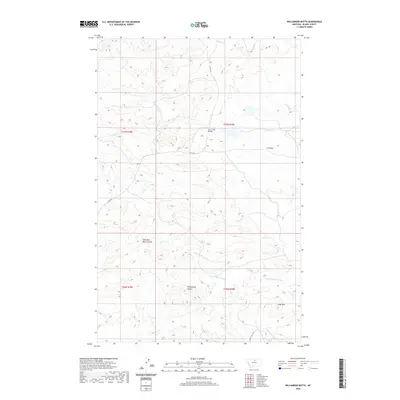
2020 Map of Williamson Butte
USGS Topo · Published 2020About this map
Williamson Butte and Goat Mtn anchor this expansive landscape in Blaine County, where the high plains are deeply dissected by a network of drainage channels. The terrain is characterized by broad plateaus like T U Bench and a series of coulees that suggest a long history of water erosion and seasonal runoff. Modern infrastructure is represented by Lloyd Rd and Golden Valley Rd, which provide access to this ranching and grazing country.
Find a feature on this map
18 named features on this map. Tap any name to fly to it.
Don’t see what you’re looking for? This feature index may not catch every label — zoom into the map to look around manually.
Map Details
Editions of this 2020 Williamson Butte Map
This is the sole edition of this map. No revisions or reprints were ever made.
Other maps of this area

1953 · Havre
USGS Topo · 1:250,000

1954 · Lewistown
USGS Topo · 1:250,000

1956 · Maddux
USGS Topo · 1:62,500

1956 · Rattlesnake
USGS Topo · 1:62,500

1957 · Havre
USGS Topo · 1:250,000

1958 · Havre
USGS Topo · 1:250,000

1959 · Lewistown
USGS Topo · 1:250,000
1985 · Nolan Reservoir
USGS Topo · 1:24,000
1985 · Sandpiper Reservoir
USGS Topo · 1:24,000
1985 · Saddle Rock
USGS Topo · 1:24,000