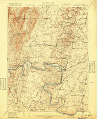
1912 Map of Williamsport
USGS Topo · Published 1920About this map
The Potomac River carves a deep, serpentine path through this borderland, where the Chesapeake and Ohio Canal parallels the water's edge past engineering landmarks like Four Locks, Dam No 5, and Dam No 4. The landscape is defined by the intersection of three states and the historic Mason and Dixon Line, which marks the northern boundary above Williamsport. Industrial and transport hubs are central to the region, from the Green Spring Furnace and Cumbo Yard to the numerous mills such as Fairview Mill and Cushwa Mill powered by the winding Conococheague Creek. Cultural and educational life is anchored by local institutions like St James School and Union Church, while small settlements such as Shady Bower and High Germany dot the ridges and valleys between the Bear Pond Mountains and North Mountain.
Find a feature on this map
147 named features on this map. Tap any name to fly to it.
Don’t see what you’re looking for? This feature index may not catch every label — zoom into the map to look around manually.
Map Details
Editions of this 1912 Williamsport Map
3 editions found

Other maps of this area

1884 · Harpers Ferry
USGS Topo · 1:125,000

1891 · Harpers Ferry
USGS Topo · 1:125,000

1893 · Harpers Ferry
USGS Topo · 1:125,000

1894 · Winchester
USGS Topo · 1:125,000

1899 · Hancock
USGS Topo · 1:62,500

1900 · Mercersburg
USGS Topo · 1:62,500

1901 · Hancock
USGS Topo · 1:62,500

1902 · Chambersburg
USGS Topo · 1:62,500

1902 · Mercersburg
USGS Topo · 1:62,500

1908 · Middletown
USGS Topo · 1:48,000