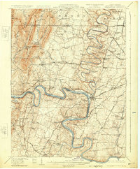
1912 Map of Williamsport
USGS Topo · Published 1924About this map
The Potomac River winds through the heart of this tri-state borderland, serving as the definitive line between Maryland and West Virginia. This 1912 survey, reprinted in 1924, captures the industrial and agricultural landscape where the Chesapeake and Ohio Canal hugs the river's bends, passing through Williamsport and past the distinctive Dellinger Widewater. The complex transportation network of the era is on full display, from the Baltimore and Ohio Railroad to the Hagerstown Electric Railway, which connects smaller settlements like Huyett and Kemps.
Find a feature on this map
122 named features on this map. Tap any name to fly to it.
Don’t see what you’re looking for? This feature index may not catch every label — zoom into the map to look around manually.
Map Details
Editions of this 1912 Williamsport Map
3 editions found

Other maps of this area

1884 · Harpers Ferry
USGS Topo · 1:125,000

1891 · Harpers Ferry
USGS Topo · 1:125,000

1893 · Harpers Ferry
USGS Topo · 1:125,000

1894 · Winchester
USGS Topo · 1:125,000

1899 · Hancock
USGS Topo · 1:62,500

1900 · Mercersburg
USGS Topo · 1:62,500

1901 · Hancock
USGS Topo · 1:62,500

1902 · Chambersburg
USGS Topo · 1:62,500

1902 · Mercersburg
USGS Topo · 1:62,500

1908 · Middletown
USGS Topo · 1:48,000