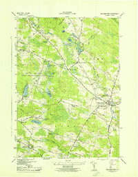
1943 Map of Williamstown
USGS Topo · Published 1943About this map
The New York Central railroad cuts a diagonal path through this 1943 survey of Oswego County, connecting the rural communities of Williamstown and Kasoag. The landscape is defined by an intricate network of water bodies, including Kasoag Lake, Whitney Pond, and the Salmon River, alongside the protected acreage of the Happy Valley Game Management Area. This era shows a community structured around its localized school system, with numerous numbered schoolhouses like School No 4 and School No 6 serving the outlying hills.
Find a feature on this map
55 named features on this map. Tap any name to fly to it.
Don’t see what you’re looking for? This feature index may not catch every label — zoom into the map to look around manually.
Map Details
Editions of this 1943 Williamstown Map
This is the sole edition of this map. No revisions or reprints were ever made.
Other maps of this area

1895 · Pulaski
USGS Topo · 1:62,500

1903 · Orwell
USGS Topo · 1:62,500

1905 · Orwell
USGS Topo · 1:62,500

1905 · Mexico
USGS Topo · 1:62,500

1906 · Kasoag
USGS Topo · 1:62,500

1942 · Redfield
USGS Topo · 1:24,000

1943 · Redfield
USGS Topo · 1:31,680

1943 · Westdale
USGS Topo · 1:31,680

1943 · Camden West
USGS Topo · 1:31,680

1943 · Richland
USGS Topo · 1:31,680