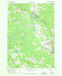
1960 Map of Williamstown
USGS Topo · Published 1962About this map
The Little Salmon River and its various branches dominate the central Oswego County landscape on this 1960 survey, a region characterized by significant state-managed lands and numerous small water bodies. The Happy Valley Game Management Area and the State Reforestation Area occupy much of the terrain, interspersed with local family and community landmarks such as Checkered House and the Madison Cem. To the north, the cluster of Sisley Ponds, Green Pond, and Black Pond surround the community of Kasoag and the recreational waters of Kasoag Lake.
Find a feature on this map
72 named features on this map. Tap any name to fly to it.
Don’t see what you’re looking for? This feature index may not catch every label — zoom into the map to look around manually.
Map Details
Editions of this 1960 Williamstown Map
3 editions found
Other maps of this area

1895 · Pulaski
USGS Topo · 1:62,500

1903 · Orwell
USGS Topo · 1:62,500

1905 · Orwell
USGS Topo · 1:62,500

1905 · Mexico
USGS Topo · 1:62,500

1906 · Kasoag
USGS Topo · 1:62,500

1942 · Redfield
USGS Topo · 1:24,000

1943 · Redfield
USGS Topo · 1:31,680

1943 · Westdale
USGS Topo · 1:31,680

1943 · Camden West
USGS Topo · 1:31,680

1943 · Richland
USGS Topo · 1:31,680