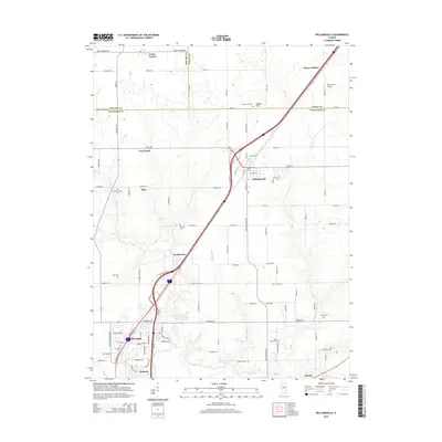
2015 Map of Williamsville
USGS Topo · Published 2015About this map
Williamsville and Sherman serve as the primary hubs in this central Illinois landscape, which straddles the junction of Menard, Logan, and Sangamon counties. The area is defined by the drainage basins of Wolf Creek and Fancy Creek, where the terrain gently rises toward Mount Fulcher in the northeast. This 2015 record documents a region shaped by agricultural roots and modern transit, with the Interstate 55 corridor cutting a diagonal path through established farming communities. Genealogists will find a high density of rural burial grounds preserved here, including Fancy Creek Cemetery and Wolf Creek Cemetery. Smaller named locales such as Peabody, Barclay, and Van Wood highlight the distributed settlement patterns common to the Illinois prairie. The map also features aviation history at Bock Farms Airport, providing a detailed look at land use just before the most recent decade of suburban expansion north of Springfield.
Find a feature on this map
69 named features on this map. Tap any name to fly to it.
Don’t see what you’re looking for? This feature index may not catch every label — zoom into the map to look around manually.
Map Details
Editions of this 2015 Williamsville Map
This is the sole edition of this map. No revisions or reprints were ever made.
Other maps of this area

1907 · Springfield
USGS Topo · 1:62,500

1911 · Lincoln
USGS Topo · 1:62,500

1913 · Lincoln
USGS Topo · 1:62,500

1930 · Springfield
USGS Topo · 1:62,500

1940 · Springfield
USGS Topo · 1:62,500

1948 · Mason City
USGS Topo · 1:62,500

1949 · Mason City
USGS Topo · 1:62,500

1950 · Springfield West
USGS Topo · 1:24,000

1950 · Springfield East
USGS Topo · 1:24,000

1954 · Mechanicsburg
USGS Topo · 1:62,500