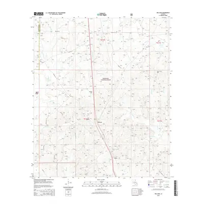
2015 Map of Williana
USGS Topo · Published 2015About this map
The settlement of Williana lies at a crossroads in the heart of Kisatchie National Forest, surrounded by the dense timberlands and creek-fed bottoms of Grant Parish. This landscape is defined by its water and elevation, from the heights of Mosley Hill and Johns Hills to the broad expanse of Big Prairie. In the western portion of the map, the Spanish Mound stands near the headwaters of Iatt Cr, serving as a distinct landmark in an area otherwise dominated by the winding paths of Saddle Bayou and Camp Pond Cr.
Find a feature on this map
48 named features on this map. Tap any name to fly to it.
Don’t see what you’re looking for? This feature index may not catch every label — zoom into the map to look around manually.
Map Details
Editions of this 2015 Williana Map
This is the sole edition of this map. No revisions or reprints were ever made.
Other maps of this area

1932 · Colfax NE
USGS Topo · 1:31,680

1932 · Colfax SW
USGS Topo · 1:31,680

1932 · Colfax SE
USGS Topo · 1:31,680

1932 · Colfax NW
USGS Topo · 1:31,680

1936 · Colfax
USGS Topo · 1:62,500

1936 · Pollock
USGS Topo · 1:62,500

1941 · Pollock
USGS Topo · 1:62,500

1950 · Winnfield
USGS Topo · 1:62,500

1951 · Winnfield
USGS Topo · 1:62,500

1953 · Alexandria
USGS Topo · 1:250,000