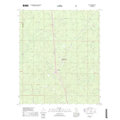
2018 Map of Williana
USGS Topo · Published 2018About this map
Williana serves as the central point of this 2018 survey, situated within the dense woodlands of the Kisatchie National Forest. This section of Grant Parish is defined by a complex network of bayous and creeks, including Saddle Bayou, Log Bayou, and the winding Indian Cr, which carve through the landscape south of the Winn Parish and Grant Parish line. Historical markers and local landmarks provide essential context for researchers, such as the Spanish Mound located west of Mosley Hill. Local genealogy is well-supported by the presence of Liberty Chapel and the adjacent Liberty Chapel Cem, which anchor the rural community. The map also traces established routes like Military Rd and Liberty Chapel Rd, illustrating the intersection of modern forestry management and long-standing local settlements.
Find a feature on this map
51 named features on this map. Tap any name to fly to it.
Don’t see what you’re looking for? This feature index may not catch every label — zoom into the map to look around manually.
Map Details
Editions of this 2018 Williana Map
This is the sole edition of this map. No revisions or reprints were ever made.
Other maps of this area

1932 · Colfax NE
USGS Topo · 1:31,680

1932 · Colfax SW
USGS Topo · 1:31,680

1932 · Colfax SE
USGS Topo · 1:31,680

1932 · Colfax NW
USGS Topo · 1:31,680

1936 · Colfax
USGS Topo · 1:62,500

1936 · Pollock
USGS Topo · 1:62,500

1941 · Pollock
USGS Topo · 1:62,500

1950 · Winnfield
USGS Topo · 1:62,500

1951 · Winnfield
USGS Topo · 1:62,500

1953 · Alexandria
USGS Topo · 1:250,000