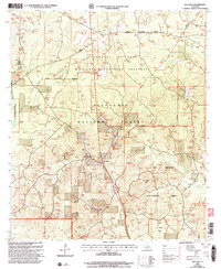
2003 Map of Williana
USGS Topo · Published 2005About this map
The settlement of Williana serves as a central point in this northern Louisiana landscape, which is heavily defined by the intersecting boundaries of the Catahoula National Wildlife Management Preserve and the Kisatchie National Forest. This 2003 revision reveals a region carefully managed for conservation and specific use, including restricted zones such as the No Ground Penetration Area and No Entry Area.
Find a feature on this map
30 named features on this map. Tap any name to fly to it.
Don’t see what you’re looking for? This feature index may not catch every label — zoom into the map to look around manually.
Map Details
Editions of this 2003 Williana Map
This is the sole edition of this map. No revisions or reprints were ever made.
Other maps of this area

1932 · Colfax NE
USGS Topo · 1:31,680

1932 · Colfax SW
USGS Topo · 1:31,680

1932 · Colfax SE
USGS Topo · 1:31,680

1932 · Colfax NW
USGS Topo · 1:31,680

1936 · Colfax
USGS Topo · 1:62,500

1936 · Pollock
USGS Topo · 1:62,500

1941 · Pollock
USGS Topo · 1:62,500

1950 · Winnfield
USGS Topo · 1:62,500

1951 · Winnfield
USGS Topo · 1:62,500

1953 · Alexandria
USGS Topo · 1:250,000