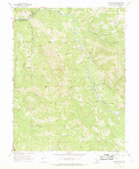
1966 Map of Willis Ridge
USGS Topo · Published 1969About this map
Farley and its station along the Northwestern Pacific railroad anchor the northwestern corner of this mid-1960s terrain study. The landscape is defined by the deep winding canyon of the Eel River, which cuts through the heart of the quadrangle between massive formations like Willis Ridge and Shimmin Ridge. This is a territory of high peaks and drainage networks, where Bald Mountain rises above the confluence of Bloody Run and Tomki Creek.
Find a feature on this map
65 named features on this map. Tap any name to fly to it.
Don’t see what you’re looking for? This feature index may not catch every label — zoom into the map to look around manually.
Map Details
Editions of this 1966 Willis Ridge Map
3 editions found
Other maps of this area

1922 · Willits
USGS Topo · 1:62,500

1929 · Eden Valley
USGS Topo · 1:62,500

1942 · Willits
USGS Topo · 1:62,500

1943 · Pomo
USGS Topo · 1:62,500

1944 · Willits
USGS Topo · 1:62,500

1951 · Laytonville
USGS Topo · 1:62,500

1952 · Eden Valley
USGS Topo · 1:62,500

1957 · Ukiah
USGS Topo · 1:250,000

1960 · Ukiah
USGS Topo · 1:250,000

1960 · Potter Valley
USGS Topo · 1:62,500