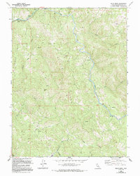
1966 Map of Willis Ridge
USGS Topo · Published 1994About this map
The Eel River carves a winding path through this northern California landscape, documented during a period of transition as 1960s data was revised in the late 1980s. The small settlement at Farley sits along the northwestern edge, serving as a rare point of habitation amidst a series of prominent landforms like Willis Ridge and Shimmins Ridge. The river's course is marked by a Gaging Station and various river miles, indicating its importance for water management and monitoring.
Find a feature on this map
34 named features on this map. Tap any name to fly to it.
Don’t see what you’re looking for? This feature index may not catch every label — zoom into the map to look around manually.
Map Details
Editions of this 1966 Willis Ridge Map
3 editions found
Other maps of this area

1922 · Willits
USGS Topo · 1:62,500

1929 · Eden Valley
USGS Topo · 1:62,500

1942 · Willits
USGS Topo · 1:62,500

1943 · Pomo
USGS Topo · 1:62,500

1944 · Willits
USGS Topo · 1:62,500

1951 · Laytonville
USGS Topo · 1:62,500

1952 · Eden Valley
USGS Topo · 1:62,500

1957 · Ukiah
USGS Topo · 1:250,000

1960 · Ukiah
USGS Topo · 1:250,000

1960 · Potter Valley
USGS Topo · 1:62,500