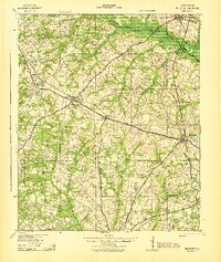
1943 Map of Williston
USGS Topo · Published 1943About this map
Williston and Blackville serve as the primary hubs on this World War II era survey, situated along the Southern railroad line. The landscape is defined by the South Fork Edisto River, which forms a winding boundary at the northern edge of the sheet. Between these settlements, the rural South Carolina interior is dotted with a dense network of local institutions that suggest a deeply rooted agrarian society. Numerous water-powered sites such as Bells Mill, Woodward Mill, and Willis Mill are situated along the various branches and creeks feeding into the larger river system.
Find a feature on this map
62 named features on this map. Tap any name to fly to it.
Don’t see what you’re looking for? This feature index may not catch every label — zoom into the map to look around manually.
Map Details
Editions of this 1943 Williston Map
2 editions found

Other maps of this area

1919 · Olar
USGS Topo · 1:62,500

1919 · Bamberg
USGS Topo · 1:48,000

1919 · Allendale
USGS Topo · 1:62,500

1920 · Ellenton
USGS Topo · 1:48,000

1920 · Bamberg
USGS Topo · 1:62,500

1920 · Aiken
USGS Topo · 1:48,000

1920 · Talatha
USGS Topo · 1:48,000

1921 · Aiken
USGS Topo · 1:62,500

1921 · Talatha
USGS Topo · 1:62,500

1921 · Ellenton
USGS Topo · 1:62,500