
1967 Map of Willow Creek
USGS Topo · Published 1971About this map
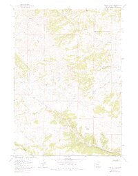
The Wind River Indian Reservation Boundary meanders diagonally across this Hot Springs County landscape, demarcating a significant cultural and administrative division in the high country. The terrain is defined by an intricate network of drainages that feed into the larger basin system, notably the South Fork Owl Creek and its various tributaries like the Middle Branch Owl Creek and South Branch Owl Creek. This mid-century survey reveals a wilderness mostly accessible by Jeep Trail, highlighting the area's isolation and its primary use for ranching or resource management rather than permanent settlement.
Find a feature on this map
23 named features on this map. Tap any name to fly to it.
Don’t see what you’re looking for? This feature index may not catch every label — zoom into the map to look around manually.
Map Details
Editions of this 1967 Willow Creek Map
2 editions found
Other maps of this area

1904 · Kirwin
USGS Topo · 1:125,000

1906 · Kirwin
USGS Topo · 1:125,000

1952 · Antelope Ridge
USGS Topo · 1:24,000

1955 · Thermopolis
USGS Topo · 1:250,000

1956 · Milk Creek
USGS Topo · 1:24,000

1958 · Thermopolis
USGS Topo · 1:250,000

1962 · Thermopolis
USGS Topo · 1:250,000
1965 · Eagle Nest Ranch
USGS Topo · 1:24,000
1967 · Circle Ridge
USGS Topo · 1:24,000

1967 · Monument Peak
USGS Topo · 1:24,000