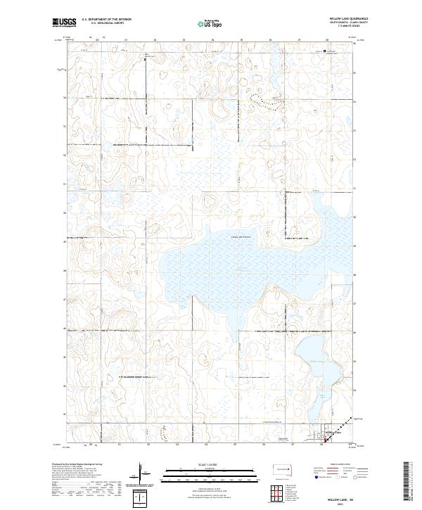
2021 Map of Willow Lake
USGS Topo · Published 2021About this map
Willow Lake anchors the southeastern corner of this South Dakota landscape, where the town of the same name sits just north of S Dakota Highway 28. This region is characterized by the distinct topography of the Coteau des Prairies, a high plateau that influences the drainage patterns of local waterways like Redstone Cr and Pearl Cr. The survey captures a high concentration of prairie potholes and seasonal basins, most notably the large expanse of Dry Lake Number Two at the center of the sheet and the nearby Mud Lake. For those researching family history in Clark County, the map identifies several local burial sites including West Merton Cem to the north and Saint James Catholic Cem near the town site, alongside the Good Hope Lutheran Cem.
Find a feature on this map
23 named features on this map. Tap any name to fly to it.
Don’t see what you’re looking for? This feature index may not catch every label — zoom into the map to look around manually.
Map Details
Editions of this 2021 Willow Lake Map
This is the sole edition of this map. No revisions or reprints were ever made.
Other maps of this area

1953 · Watertown
USGS Topo · 1:250,000

1958 · Watertown
USGS Topo · 1:250,000

1973 · Carpenter SE
USGS Topo · 1:24,000

1973 · Willow Lake
USGS Topo · 1:24,000

1973 · Clark South
USGS Topo · 1:24,000

1973 · Vienna West
USGS Topo · 1:24,000
1973 · Cherry Lake
USGS Topo · 1:24,000

1973 · Naples
USGS Topo · 1:24,000
1973 · Willow Lake SW
USGS Topo · 1:24,000
1973 · Raymond SE
USGS Topo · 1:24,000