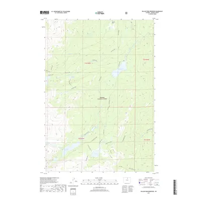
2017 Map of Willow Park Reservoir
USGS Topo · Published 2017About this map
Bighorn National Forest serves as the backdrop for this high-altitude landscape in Johnson County, defined by its intricate network of reservoirs, alpine lakes, and drainage systems. The hydrography of the region is centered on the Willow Park Reservoir and the Cloud Peak Reservoir, which manage the flow of S Piney Cr and N Piney Cr. The presence of the Rock Cr and Piney Diversion Ditch near Penrose Park illustrates the engineering required to move water across this complex terrain. For recreation and transit, the Solitude Loop and Story Penrose routes weave through the forest, connecting numerous water bodies such as Lake Mead, Gem Lake, and the Beaver Lakes. These trails and named shortcuts like Tut's-038 Shortcut provide a look at how travelers navigated the peaks and valleys between Penrose Cr and Middle Rock Creek during the early 21st century.
Find a feature on this map
35 named features on this map. Tap any name to fly to it.
Don’t see what you’re looking for? This feature index may not catch every label — zoom into the map to look around manually.
Map Details
Editions of this 2017 Willow Park Reservoir Map
This is the sole edition of this map. No revisions or reprints were ever made.
Other maps of this area

1895 · Dayton
USGS Topo · 1:125,000

1899 · Cloud peak
USGS Topo · 1:125,000

1900 · Fort McKinney
USGS Topo · 1:125,000

1901 · Cloud Peak
USGS Topo · 1:125,000

1901 · Dayton
USGS Topo · 1:125,000

1903 · Fort McKinney
USGS Topo · 1:125,000

1909 · Sheridan
USGS Topo · 1:125,000

1911 · Sheridan
USGS Topo · 1:125,000

1955 · Sheridan
USGS Topo · 1:250,000

1958 · Sheridan
USGS Topo · 1:250,000