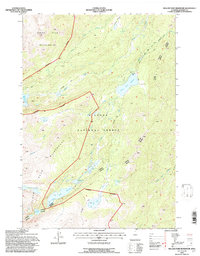
1993 Map of Willow Park Reservoir
USGS Topo · Published 1997About this map
High alpine hydrology and remote backcountry management define this portion of the Bighorn National Forest during the 1990s. The area is dominated by the Cloud Peak Wilderness, where rugged elevations are marked by a series of distinct water bodies including Beaver Lakes, Frying Pan Lake, and Flatiron Lake. The Willow Park Reservoir stands as a central landmark for water management, supported by a Gaging Sta and the nearby Happ Cow Camp.
Find a feature on this map
26 named features on this map. Tap any name to fly to it.
Don’t see what you’re looking for? This feature index may not catch every label — zoom into the map to look around manually.
Map Details
Editions of this 1993 Willow Park Reservoir Map
This is the sole edition of this map. No revisions or reprints were ever made.
Other maps of this area

1895 · Dayton
USGS Topo · 1:125,000

1899 · Cloud peak
USGS Topo · 1:125,000

1900 · Fort McKinney
USGS Topo · 1:125,000

1901 · Cloud Peak
USGS Topo · 1:125,000

1901 · Dayton
USGS Topo · 1:125,000

1903 · Fort McKinney
USGS Topo · 1:125,000

1909 · Sheridan
USGS Topo · 1:125,000

1911 · Sheridan
USGS Topo · 1:125,000

1955 · Sheridan
USGS Topo · 1:250,000

1958 · Sheridan
USGS Topo · 1:250,000