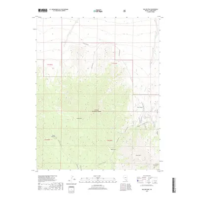
2018 Map of Willow Peak
USGS Topo · Published 2018About this map
Willow Peak and the high ridges of the Spring Mountains dominate this high-altitude landscape within the Toiyabe National Forest. The map documents a critical drainage and transit area where the northern reaches of the Mojave Desert transition into steeper terrain. This 2018 survey details an intricate network of primitive roads and paths essential for mountain access, including the Wilderness Trail and Wheeler Peak Road. Water sources are the primary landmarks in this arid environment, with several vital points such as Willow Spring, Oak Spring, and Cougar Springs identified along the slopes. The inclusion of Wheeler Pass highlights a traditional route through the range, while the canyons and washes, such as Willow Canyon and Willow Creek, illustrate the hydrologic patterns that have shaped the local topography and historical movement through Clark County.
Find a feature on this map
32 named features on this map. Tap any name to fly to it.
Don’t see what you’re looking for? This feature index may not catch every label — zoom into the map to look around manually.
Map Details
Editions of this 2018 Willow Peak Map
This is the sole edition of this map. No revisions or reprints were ever made.
Other maps of this area

1907 · Las Vegas
USGS Topo · 1:250,000

1908 · Las Vegas
USGS Topo · 1:250,000

1942 · Indian Spring
USGS Topo · 1:125,000

1952 · Mercury
USGS Topo · 1:62,500

1954 · Las Vegas
USGS Topo · 1:250,000

1957 · Las Vegas
USGS Topo · 1:250,000

1957 · Mt. Stirling
USGS Topo · 1:62,500

1957 · Charleston Peak
USGS Topo · 1:62,500

1959 · Las Vegas
USGS Topo · 1:250,000

1962 · Las Vegas
USGS Topo · 1:250,000