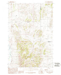
1986 Map of Willow Springs
USGS Topo · Published 1986About this map
Big Mountain dominates the southern landscape of this mid-1980s provisional study, overlooking the winding path of the Boulder River as it cuts through the valley floor. The terrain reveals a history of extraction and exploration, with numerous Mine Shafts and Prospects clustered near the namesake Willow Springs and across the high ridges. These labels indicate a landscape defined by small-scale mineral ventures rather than large industrial hubs.
Find a feature on this map
10 named features on this map. Tap any name to fly to it.
Don’t see what you’re looking for? This feature index may not catch every label — zoom into the map to look around manually.
Map Details
Editions of this 1986 Willow Springs Map
This is the sole edition of this map. No revisions or reprints were ever made.
Other maps of this area

1886 · Fort Logan
USGS Topo · 1:250,000

1888 · Three Forks
USGS Topo · 1:250,000

1894 · Three Forks
USGS Topo · 1:250,000

1895 · Three Forks
USGS Topo · 1:250,000

1947 · Bozeman
USGS Topo · 1:250,000

1948 · Bozeman
USGS Topo · 1:250,000

1948 · White Sulphur Springs
USGS Topo · 1:250,000

1949 · Radersburg
USGS Topo · 1:62,500

1950 · Devils Fence
USGS Topo · 1:62,500

1950 · Three Forks
USGS Topo · 1:62,500