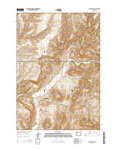
2014 Map of Willowdale
USGS Topo · Published 2014About this map
Willowdale serves as the central point of interest in this high-desert landscape where the border of Wasco and Jefferson Counties meets. The terrain is defined by a complex network of drainages and dramatic landforms, from the broad Trout Creek Valley to the sharp rises of The Flatirons and Friends Peak. Transportation patterns are anchored by Us-97 and the winding Antelope Hwy, which navigate the deep cuts of Cow Canyon and Bull Canyon.
Find a feature on this map
34 named features on this map. Tap any name to fly to it.
Don’t see what you’re looking for? This feature index may not catch every label — zoom into the map to look around manually.
Map Details
Editions of this 2014 Willowdale Map
This is the sole edition of this map. No revisions or reprints were ever made.
Other maps of this area

1928 · Madras
USGS Topo · 1:125,000

1931 · Madras
USGS Topo · 1:125,000

1955 · Bend
USGS Topo · 1:250,000

1957 · Bend
USGS Topo · 1:250,000

1958 · Bend
USGS Topo · 1:250,000
1962 · Kaskela
USGS Topo · 1:24,000

1962 · Gateway
USGS Topo · 1:24,000
1963 · Madras East
USGS Topo · 1:24,000

1966 · Willowdale
USGS Topo · 1:62,500

1968 · Ashwood
USGS Topo · 1:24,000