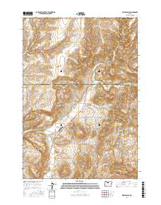
2017 Map of Willowdale
USGS Topo · Published 2017About this map
Willowdale serves as a central point in this landscape where the high desert terrain of Wasco and Jefferson Counties meet. The geography is defined by a complex system of drainage and relief, ranging from the prominent heights of Friends Peak and Pony Butte to the dramatic incisions of Cow Canyon and Bull Canyon. The presence of Cram Ditch and various water sources like Bostick Spring and Cow Canyon Springs indicates the vital importance of water management in this arid region of Central Oregon.
Find a feature on this map
32 named features on this map. Tap any name to fly to it.
Don’t see what you’re looking for? This feature index may not catch every label — zoom into the map to look around manually.
Map Details
Editions of this 2017 Willowdale Map
This is the sole edition of this map. No revisions or reprints were ever made.
Other maps of this area

1928 · Madras
USGS Topo · 1:125,000

1931 · Madras
USGS Topo · 1:125,000

1955 · Bend
USGS Topo · 1:250,000

1957 · Bend
USGS Topo · 1:250,000

1958 · Bend
USGS Topo · 1:250,000
1962 · Kaskela
USGS Topo · 1:24,000

1962 · Gateway
USGS Topo · 1:24,000
1963 · Madras East
USGS Topo · 1:24,000

1966 · Willowdale
USGS Topo · 1:62,500

1968 · Ashwood
USGS Topo · 1:24,000