
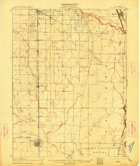
1906 Map of Willows
USGS Topo · Published 1906About this map
The Sacramento River forms the eastern boundary of this 1904 survey, where early irrigation infrastructure began to reshape the landscape of the northern Central Valley. The Central Irrigation Canal cuts across the plains, evidence of the transition from dry-land grazing to more intensive agriculture. The Southern Pacific railroad corridor serves as the primary spine for settlement, connecting Orland, Germantown, Lyman, and the county seat at Willows. Extensive land grants like Larkins Children's Rancho and Capay still define large swaths of territory, while river-dependent sites like Sidds Ldg and the Swift Point Warehouse highlight the era's reliance on waterborne transport. The western portion of the map is defined by a series of intermittent streams, including North Fork Willow Creek and French Creek, which flow toward the rail-aligned towns.
Find a feature on this map
26 named features on this map. Tap any name to fly to it.
Don’t see what you’re looking for? This feature index may not catch every label — zoom into the map to look around manually.
Map Details
Editions of this 1906 Willows Map
2 editions found
Other maps of this area

1888 · Marysville
USGS Topo · 1:125,000

1891 · Chico
USGS Topo · 1:125,000

1891 · Marysville
USGS Topo · 1:125,000

1893 · Chico
USGS Topo · 1:125,000

1894 · Marysville
USGS Topo · 1:125,000

1895 · Marysville
USGS Topo · 1:125,000

1895 · Chico
USGS Topo · 1:125,000

1904 · Vina
USGS Topo · 1:62,500

1904 · Walker Creek
USGS Topo · 1:31,680

1904 · Logan Creek
USGS Topo · 1:24,000