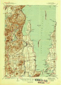
1943 Map of Willsboro
USGS Topo · Published 1946About this map
Lake Champlain dominates the landscape of this 1930s survey, where the rocky shoreline of the Adirondack State Park meets the water at Willsboro Point. The eastern shore in Vermont shows a contrast in terrain, with the Rutland RR following the more level ground through Ferrisburg. On the New York side, the Delaware and Hudson River railroad skirts the foothills of Bigelow Mtn and Rattlesnake Mtn. This era captures small shoreline communities like Craterclub and Essex alongside inland agricultural centers such as Whallonsburg and Reber. Genealogists may find interest in the numerous district schools, including Brookfield Sch and Ryan Sch, and the placement of Lakeview Cem near the lake. The map also records the Ferry crossing from Appletree Pt toward New York, a vital connection before modern bridge networks fully centralized travel.
Find a feature on this map
106 named features on this map. Tap any name to fly to it.
Don’t see what you’re looking for? This feature index may not catch every label — zoom into the map to look around manually.
Map Details
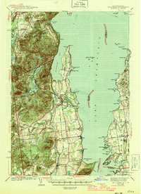
Editions of this 1943 Willsboro Map
3 editions found

Other maps of this area

1894 · Elizabethtown
USGS Topo · 1:62,500

1894 · Port Henry
USGS Topo · 1:62,500

1894 · Plattsburg
USGS Topo · 1:62,500

1895 · Willsboro
USGS Topo · 1:62,500

1895 · Elizabethtown
USGS Topo · 1:62,500

1895 · Ausable
USGS Topo · 1:62,500

1898 · Port Henry
USGS Topo · 1:62,500

1901 · Elizabethtown
USGS Topo · 1:62,500

1903 · Ausable
USGS Topo · 1:62,500

1903 · Middlebury
USGS Topo · 1:62,500