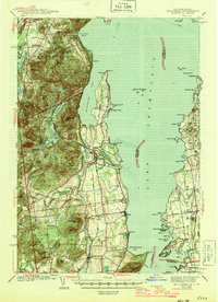
1943 Map of Willsboro
USGS Topo · Published 1946About this map
Lake Champlain dominates the eastern half of this mid-century survey, defining the rugged coastline of Essex County as it meets the Vermont shore. The interior landscape is shaped by the steep peaks of the Adirondack State Park, including Rattlesnake Mtn and East Bouquet Mtn, which overlook a network of valley settlements. The industrial and transport backbone of the era is evident in the path of the Delaware and Hudson RR hugging the shoreline through Willsboro and Whallonsburg, while the Rutland RR serves the Vermont side near Charlotte. Local life is recorded through numerous rural landmarks, from the Brookfield Sch and St Josephs Ch to the lakeside enclave of Craterclub. The map captures the transition from the high Adirondack timberlands to the fertile maritime corridor of the lake before post-war development altered these small communities.
Find a feature on this map
99 named features on this map. Tap any name to fly to it.
Don’t see what you’re looking for? This feature index may not catch every label — zoom into the map to look around manually.
Map Details
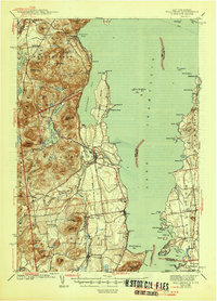
Editions of this 1943 Willsboro Map
3 editions found

Other maps of this area

1894 · Elizabethtown
USGS Topo · 1:62,500

1894 · Port Henry
USGS Topo · 1:62,500

1894 · Plattsburg
USGS Topo · 1:62,500

1895 · Willsboro
USGS Topo · 1:62,500

1895 · Elizabethtown
USGS Topo · 1:62,500

1895 · Ausable
USGS Topo · 1:62,500

1898 · Port Henry
USGS Topo · 1:62,500

1901 · Elizabethtown
USGS Topo · 1:62,500

1903 · Ausable
USGS Topo · 1:62,500

1903 · Middlebury
USGS Topo · 1:62,500