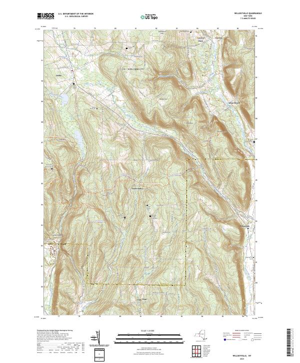
2023 Map of Willseyville
USGS Topo · Published 2023About this map
Danby and the surrounding hamlets of South Danby and Crum Town anchor this landscape, where the high ridges of the Finger Lakes region are deeply incised by the headwaters of Willseyville Creek and Danby Creek. The area maintains its rural character through numerous small family and community burial grounds, such as the Michael Handy Farm Cem and Mandeville Cem, which offer significant value for genealogical research in this part of Tompkins County.
Find a feature on this map
82 named features on this map. Tap any name to fly to it.
Don’t see what you’re looking for? This feature index may not catch every label — zoom into the map to look around manually.
Map Details
Editions of this 2023 Willseyville Map
This is the sole edition of this map. No revisions or reprints were ever made.
Other maps of this area

1893 · Ithaca
USGS Topo · 1:62,500

1895 · Ithaca
USGS Topo · 1:62,500

1900 · Dryden
USGS Topo · 1:62,500

1902 · Waverly
USGS Topo · 1:62,500

1903 · Owego
USGS Topo · 1:62,500

1905 · Watkins Glen
USGS Topo · 1:125,000

1906 · Catatonk
USGS Topo · 1:125,000

1949 · Ithaca West
USGS Topo · 1:24,000

1949 · Ithaca East
USGS Topo · 1:24,000

1949 · Willseyville
USGS Topo · 1:24,000