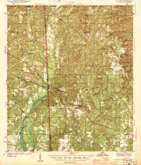
1944 Map of Wilmer
USGS Topo · Published 1944About this map
The Escatawpa River defines the western boundary of this landscape, separating the borderlands of Mississippi and Alabama during the early 1940s. Centered on the community of Wilmer, the terrain is heavily dissected by a network of creeks including Puppy Creek, Big Creek, and Collins Creek. This rural district is characterized by its dispersed community infrastructure, featuring local landmarks like the Luce Fire Tower and several remote schoolhouses such as Moffet Sch and Stringfellow Sch. The map reveals the early settlement patterns of northwest Mobile County, where small gathering points like Semmes and Georgetown are anchored by their respective churches and burial grounds. Fording points and river crossings are noted by structures like Howell Bridge, while the lowland areas are marked by marshy depressions such as Dean Bay and Waters Bay.
Find a feature on this map
50 named features on this map. Tap any name to fly to it.
Don’t see what you’re looking for? This feature index may not catch every label — zoom into the map to look around manually.
Map Details
Editions of this 1944 Wilmer Map
2 editions found

Other maps of this area

1922 · Mobile
USGS Topo · 1:62,500

1940 · Mobile
USGS Topo · 1:62,500

1941 · Hurley
USGS Topo · 1:62,500

1941 · Vancleave
USGS Topo · 1:62,500

1941 · Creola
USGS Topo · 1:62,500

1941 · Lucedale
USGS Topo · 1:62,500

1942 · Kushla
USGS Topo · 1:31,680

1942 · Deer Park
USGS Topo · 1:62,500

1942 · Wilmer
USGS Topo · 1:62,500

1943 · Lucedale
USGS Topo · 1:62,500