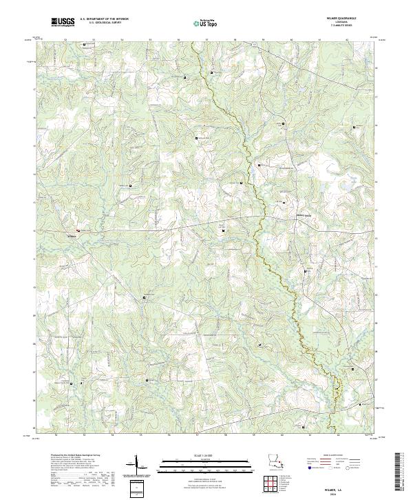
2024 Map of Wilmer
USGS Topo · Published 2024About this map
Tchefuncte River meanders southward through this rural corner of Louisiana, serving as the central drainage for a landscape defined by creeks and family-named landmarks. The area around Wilmer and Stoney Point reflects a deeply rooted settlement pattern, where small family cemeteries like Brumfield Cem, McDaniel Cem, and Casper-Lea Cem are situated on higher ground above the river bottomlands. Numerous watercourses, including Chappepeela Creek and Hamilton Creek, cut through the terrain, creating distinct geographic features such as Brushy Hollow and Brumfield Hollow. The map detail reveals a high concentration of burial sites and country churches, such as the Friendship Baptist Church Cem, which are vital for genealogists tracing family histories in the eastern portion of Tangipahoa Parish and the western edge of Washington Parish. The road network remains largely local, connecting these quiet crossroads via routes like Hwy 440 and Hwy 1061.
Find a feature on this map
127 named features on this map. Tap any name to fly to it.
Don’t see what you’re looking for? This feature index may not catch every label — zoom into the map to look around manually.
Map Details
Editions of this 2024 Wilmer Map
This is the sole edition of this map. No revisions or reprints were ever made.
Other maps of this area

1939 · Sunny Hill
USGS Topo · 1:31,680

1939 · Clifton
USGS Topo · 1:31,680

1940 · Spring Creek
USGS Topo · 1:31,680

1942 · Husser
USGS Topo · 1:31,680

1942 · Wilmer
USGS Topo · 1:31,680

1942 · Loranger
USGS Topo · 1:31,680

1949 · Bolivar
USGS Topo · 1:31,680

1950 · Folsom
USGS Topo · 1:31,680

1950 · Franklinton
USGS Topo · 1:31,680

1954 · Folsom
USGS Topo · 1:62,500