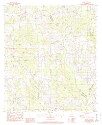
1983 Map of Wilmer
USGS Topo · Published 1984About this map
Wilmer and Stoney Point serve as the primary nodes of settlement in this part of Louisiana, where the landscape is defined by the winding course of the Tchefuncta River and its numerous tributaries. This 1980s landscape reveals a deep-rooted pattern of family-named landmarks and rural congregations, particularly evident in the high density of small burial grounds such as Brumfield Cem, Walker Cem, and Crystal Springs Ch Cem. The parish line between Washington and Tangipahoa Parish cuts through a terrain carved by Chappepeela Creek and the East Fork Big Creek. Notable community centers like Wilmer Ch and New Jerusalem Ch represent the social fabric of these rural townships. The drainage patterns, including the split between North Carson Creek and South Carson Creek, dictate the movement of roads and property boundaries throughout the quadrant.
Find a feature on this map
41 named features on this map. Tap any name to fly to it.
Don’t see what you’re looking for? This feature index may not catch every label — zoom into the map to look around manually.
Map Details
Editions of this 1983 Wilmer Map
This is the sole edition of this map. No revisions or reprints were ever made.
Other maps of this area

1939 · Sunny Hill
USGS Topo · 1:31,680

1939 · Clifton
USGS Topo · 1:31,680

1940 · Spring Creek
USGS Topo · 1:31,680

1942 · Husser
USGS Topo · 1:31,680

1942 · Wilmer
USGS Topo · 1:31,680

1942 · Loranger
USGS Topo · 1:31,680

1949 · Bolivar
USGS Topo · 1:31,680

1950 · Folsom
USGS Topo · 1:31,680

1950 · Franklinton
USGS Topo · 1:31,680

1954 · Folsom
USGS Topo · 1:62,500