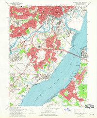
1967 Map of Wilmington South
USGS Topo · Published 1970About this map
The Christina River and Delaware River define this mid-century industrial and residential landscape, showing the intensive post-war development south of Wilmington. The map captures a moment of significant infrastructure growth, with the massive Delaware Memorial Bridges connecting Delaware to Pennsville in New Jersey. Inland, the footprint of the Greater Wilmington Airport dominates the terrain near Wilmington Manor, while the Penn Central and Baltimore and Ohio railroads thread through heavy industrial zones and emerging suburbs like Elsmere and Minquadale.
Find a feature on this map
93 named features on this map. Tap any name to fly to it.
Don’t see what you’re looking for? This feature index may not catch every label — zoom into the map to look around manually.
Map Details
Editions of this 1967 Wilmington South Map
3 editions found
Other maps of this area

1890 · Salem
USGS Topo · 1:62,500

1894 · Chester
USGS Topo · 1:62,500

1896 · Chester
USGS Topo · 1:62,500

1898 · Salem
USGS Topo · 1:62,500

1898 · Chester
USGS Topo · 1:62,500

1901 · Camden
USGS Topo · 1:125,000

1901 · West Chester
USGS Topo · 1:62,500

1904 · West Chester
USGS Topo · 1:62,500

1904 · Wilmington
USGS Topo · 1:62,500

1906 · Wilmington
USGS Topo · 1:62,500