
1970 Map of Wilmot NW
USGS Topo · Published 1973About this map
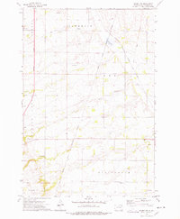
The Sisseton Indian Reservation Boundary and an older Treaty Boundary define the administrative geography of this 1970 landscape in Roberts County. The terrain is marked by the Chicago Milwaukee St Paul and Pacific railroad corridor, which cuts across the northeast corner near Mud Lake. These historical lines underscore the complex land history of the region, where township names like Springdale, Lee, Lawrence, and Summit organize the rolling prairie. Natural features such as the Whetstone River and Big Coulee drain the territory, while the isolated Boe Cem and various gravel pits offer specific points of interest for genealogists and local historians tracking early settlement and rural industry.
Find a feature on this map
16 named features on this map. Tap any name to fly to it.
Don’t see what you’re looking for? This feature index may not catch every label — zoom into the map to look around manually.
Map Details
Editions of this 1970 Wilmot NW Map
2 editions found
Other maps of this area

1916 · Peever
USGS Topo · 1:62,500

1918 · Peever
USGS Topo · 1:62,500

1953 · Milbank
USGS Topo · 1:250,000

1958 · Milbank
USGS Topo · 1:250,000

1970 · Summit
USGS Topo · 1:24,000

1970 · Summit NE
USGS Topo · 1:24,000

1970 · Marvin
USGS Topo · 1:24,000

1970 · Goodwill
USGS Topo · 1:24,000

1971 · Corona
USGS Topo · 1:24,000

1971 · Browns Valley
USGS Topo · 1:24,000