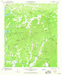
1946 Map of Wilscot
USGS Topo · Published 1969About this map
The mountain community of Morganton sits at the northern edge of this 1946 survey, overlooking the waters of Blue Ridge Lake. The landscape is dominated by the ridges of the Chattahoochee National Forest, where a network of gaps and peaks like Tipton Mtn and Licklog Mountain define the difficult terrain. A high-altitude perspective is provided at Brawley Mtn Lookout Tower, while the valleys below are threaded by the Toccoa River and its numerous tributaries.
Find a feature on this map
117 named features on this map. Tap any name to fly to it.
Don’t see what you’re looking for? This feature index may not catch every label — zoom into the map to look around manually.
Map Details
Editions of this 1946 Wilscot Map
4 editions found
Other maps of this area

1888 · Ellijay
USGS Topo · 1:125,000

1892 · Ellijay
USGS Topo · 1:125,000

1898 · Ellijay
USGS Topo · 1:125,000

1911 · Ellijay
USGS Topo · 1:125,000

1935 · Ivylog
USGS Topo · 1:24,000

1935 · Mulky Gap
USGS Topo · 1:24,000

1935 · Noontootla
USGS Topo · 1:24,000

1935 · Mineral Bluff
USGS Topo · 1:24,000

1935 · Lake Toccoa
USGS Topo · 1:24,000

1935 · Tickanetley
USGS Topo · 1:24,000