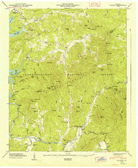
1947 Map of Wilscot
USGS Topo · Published 1947About this map
Morganton and the upper reaches of the Toccoa River define this section of the Chattahoochee National Forest in the late 1940s. The landscape is dotted with small, family-named landmarks and rural institutions that speak to the deep-rooted community of Fannin County. Numerous cemeteries such as Nixon Cem, Brown Cem, and Vanzant Cem are scattered across the valley floors, often situated near country houses of worship like Antioch Ch and Pleasant Hill Ch. The high terrain is marked by the Brawley Mtn LOOKOUT TOWER and the prominent Rocky Mountain ridge. A hydrological network of named branches and creeks, including Noontootla Creek and Skeenah Creek, flows toward Lake Toccoa, which is noted at an elevation of 1690 feet. The presence of the Sugar Hill Sch and the Gaging Station near the river indicates the essential infrastructure of this mountain region during the post-war era.
Find a feature on this map
116 named features on this map. Tap any name to fly to it.
Don’t see what you’re looking for? This feature index may not catch every label — zoom into the map to look around manually.
Map Details
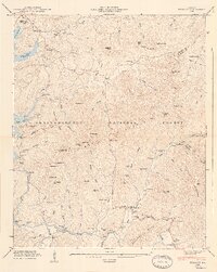
Editions of this 1947 Wilscot Map
2 editions found
Other maps of this area

1888 · Ellijay
USGS Topo · 1:125,000

1892 · Ellijay
USGS Topo · 1:125,000

1898 · Ellijay
USGS Topo · 1:125,000

1911 · Ellijay
USGS Topo · 1:125,000

1935 · Ivylog
USGS Topo · 1:24,000

1935 · Mulky Gap
USGS Topo · 1:24,000

1935 · Noontootla
USGS Topo · 1:24,000

1935 · Mineral Bluff
USGS Topo · 1:24,000

1935 · Lake Toccoa
USGS Topo · 1:24,000

1935 · Tickanetley
USGS Topo · 1:24,000