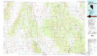
1982 Map of Wilson Creek Range
USGS Topo · Published 1982About this map
Mining operations and remote desert outposts define this high-altitude landscape in eastern Nevada during the early 1980s. The concentration of industry is most evident around the Bristol Silver Mine, Jackrabbit Mine, and Atlanta Mine, reflecting the region's long-standing reliance on mineral extraction. These sites are connected by a network of 4WD trails and remote roads that traverse the broad basins of Lake Valley and Fairview Valley.
Find a feature on this map
60 named features on this map. Tap any name to fly to it.
Don’t see what you’re looking for? This feature index may not catch every label — zoom into the map to look around manually.
Map Details
Editions of this 1982 Wilson Creek Range Map
This is the sole edition of this map. No revisions or reprints were ever made.
Other maps of this area

1885 · St. George
USGS Topo · 1:250,000

1885 · Pioche
USGS Topo · 1:250,000

1886 · Pioche
USGS Topo · 1:250,000

1891 · St. George
USGS Topo · 1:250,000

1915 · Bristol Range
USGS Topo · 1:62,500

1916 · Highland
USGS Topo · 1:62,500

1917 · Bristol Range
USGS Topo · 1:62,500

1918 · Highland
USGS Topo · 1:62,500

1921 · NW 1/4 Panaca
USGS Topo · 1:48,000

1953 · Highland Peak
USGS Topo · 1:24,000