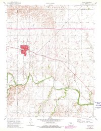
1956 Map of Wilson
USGS Topo · Published 1980About this map
Wilson serves as the focal point of this mid-century survey, situated at the intersection of a significant rail-and-river network in central Kansas. The Union Pacific railroad cuts directly through the town center, passing by the City Hall, while the wide meanders of the Smoky Hill River define the southern landscape. This area reflects a classic Great Plains settlement pattern where transportation corridors dictated growth. Beyond the town grid, the map identifies local infrastructure such as the Wilson Landing Strip and a Sewage Disposal site, alongside natural features like Wilson Creek and Blood Creek. Genealogists will find the locations of both the Wilson Cem and the Old Wilson Cem useful for family research. The map also documents the transition from Lincoln and Russell counties into Ellsworth County, showing the agricultural and industrial footprints of the era, including several gravel or clay Pits.
Find a feature on this map
21 named features on this map. Tap any name to fly to it.
Don’t see what you’re looking for? This feature index may not catch every label — zoom into the map to look around manually.
Map Details
Editions of this 1956 Wilson Map
2 editions found
Other maps of this area

1894 · Ellsworth
USGS Topo · 1:125,000

1896 · Russell
USGS Topo · 1:125,000

1955 · Great Bend
USGS Topo · 1:250,000

1956 · Wilson
USGS Topo · 1:24,000

1956 · Dorrance
USGS Topo · 1:24,000

1957 · Great Bend
USGS Topo · 1:250,000

1957 · Holyrood NE
USGS Topo · 1:24,000

1957 · Black Wolf
USGS Topo · 1:24,000

1958 · Great Bend
USGS Topo · 1:250,000
1964 · Wilson NW
USGS Topo · 1:24,000