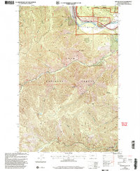
1999 Map of Wilson Gulch
USGS Topo · Published 2003About this map
Lolo National Forest dominates this Montana landscape, where the Clark Fork river cuts through the northern corner. The terrain is defined by significant elevations such as Mount Baldy, Sheep Mountain, and Blacktail Mountain, while the drainage system is recorded through numerous named features including Wilson Gulch, Oregon Gulch, and Resin Creek. The map provides a detailed view of the natural resources and land use during the late 1990s, highlighting several extractive sites like the Gravel Pit and various Prospects scattered across the ridges.
Find a feature on this map
25 named features on this map. Tap any name to fly to it.
Don’t see what you’re looking for? This feature index may not catch every label — zoom into the map to look around manually.
Map Details
Editions of this 1999 Wilson Gulch Map
This is the sole edition of this map. No revisions or reprints were ever made.
Other maps of this area

1918 · St Regis
USGS Topo · 1:125,000

1919 · St. Regis
USGS Topo · 1:125,000

1956 · St Regis
USGS Topo · 1:62,500

1956 · Wallace
USGS Topo · 1:250,000

1957 · Illinois Peak
USGS Topo · 1:62,500

1959 · Plains
USGS Topo · 1:62,500

1960 · Wallace
USGS Topo · 1:250,000

1960 · Superior
USGS Topo · 1:62,500
1985 · Superior
USGS Topo · 1:24,000
1985 · Keystone Peak
USGS Topo · 1:24,000